
TerraByte takes its geospatial tracking service to the next level with help from SkyFi and AI
Startup upgrades 'Earth Search Engine' to open new paths to high-resolution satellite imagery and data-driven insights. Read More

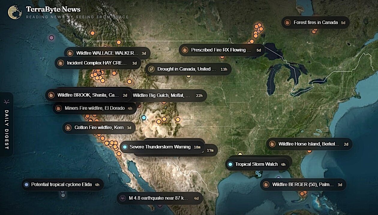
Two months after emerging from stealth mode, TerraByte AI is using artificial intelligence and a new partnership to upgrade its “Earth Search Engine.”
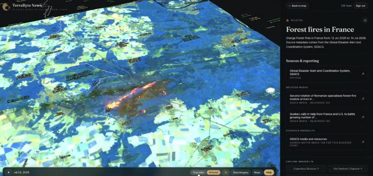
The startup, which maintains operations in Seattle as well as San Francisco, has just rolled out a TerraByte News service that pinpoints wildfires, earthquakes and severe weather events on an interactive map. Users can follow links to access news reports, social media posts and satellite views related to selected events.
The satellite views include open-source images from NASA’s Earth observation system as well as Europe’s Sentinel satellites. And now the database also features premium high-resolution pictures provided through a newly announced partnership with Texas-based SkyFi. The partnership gives TerraByte’s users access to more than 300 sources of satellite and aerial imagery for as little as $15 per image.
“In May, when we came out of stealth, we made the planet searchable,” TerraByte CEO Rishi Madhok told GeekWire. “Now, the moment you find something, you can hold the imagery in your hands within a day. The next step is making Earth intelligence as routine as a web search — you ask, you see, and then you act.”
Madhok and Fuxun Yu, TerraByte’s chief technology officer, founded the company last year as a follow-up to their work on geospatial data analysis at Microsoft. They developed search tools that can recognize features of interest in satellite images and deliver data-driven insights in response to natural-language queries.
Over the past couple of months, TerraByte’s team has grown from three to five employees, Madhok said. “Our goal is to grow the team even further this year, because we are seeing a lot of traction from users since we came out of stealth,” he said.
“A lot of traction is coming from insurance [companies], from the government, from mining, from other areas where there is the possibility to see things,” he said. “And finance, right? A lot of quant firms and hedge funds want to see all of this activity coming in.”
One key application involves emergency response. “Our big focus is on catastrophes, particularly wildfires,” Madhok said. “Our vision is that anybody should be able to track this — not limited to just journalists, but including everyone who is living in those areas and wants to see what’s going on.”
Madhok expects the revenue-sharing partnership with SkyFi to open up new opportunities. “I’m happy to say that we have customers who are paying us,” he said. “From that perspective, we’re already doing well.”
Advances in AI are creating still more opportunities. “Now you can do searches not just using text, but using images, which we call visual search,” he said. “Let’s say you’re searching for a certain kind of vessel, and it’s very hard for you to describe it in natural language. You can just take a screenshot of it, upload it, and within seconds it will literally search for what you were looking for.”
Looking ahead, Madhok and his teammates plan to add people power to the power of AI.
“This is the first version of a platform that we’re going to release, and we obviously want to learn more from our users,” he said. “We want this platform to become crowdsourced, so that people who are local to a region can add more information from that perspective, because then it starts becoming more powerful. We don’t want just TerraByte to be the owner of this.”
Madhok shared a video on LinkedIn that shows how TerraByte’s platform can quickly find high-resolution imagery of a shipwreck in Washington state’s Possession Sound:
Share
What's Your Reaction?
 Like
0
Like
0
 Dislike
0
Dislike
0
 Love
0
Love
0
 Funny
0
Funny
0
 Angry
0
Angry
0
 Sad
0
Sad
0
 Wow
0
Wow
0